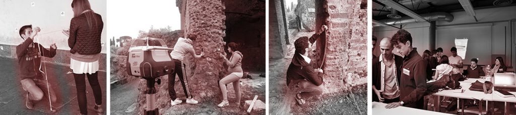
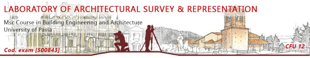
Survey Laboratory
At the end of the course the student must learn:
- historical and scientific foundations of the discipline.
- principles, methods and tools of direct and indirect survey.
- methods of instrumental survey and problems related to survey and return of complex architectural context.
- theoretical foundations of terrestrial and aerial photogrammetry applied to architecture and territory.
- principles and modalities of procedures for the photogrammetric restitution of graphic elaborates aimed at measuring and understanding architecture and environment.
- principles and methods for performing surveys with 3D laser scanners.
- methods for processing 3D data from Laser Scanners for 3D and 2D data return.
At the end of the course the student must know:
- to run a complete survey project.
- to perform the survey with direct and indirect measurement techniques.
- perform the digital drawing of survey using appropriate software tools.
- to produce digital graphic elaborations appropriate to the chosen scale of representation using elaborations based on photographic and photogrammetric restitution.
- to make digital graphic elaborations with the appropriate level of detail for the chosen representation scale using elaborations derived from digital survey, as vector data in the form of “point clouds” and or polygonal surfaces.
Informative material of the course
Themes developed by the Course
- 2012/2013 – Archaeological survey (Villa Adriana) – Urban Survey (Borgo Ticino)
- 2013/2014 – Archaeological survey (Villa Adriana) – Urban Survey (Borgo Ticino) – Architectural survey (La Verna)
- 2014/2015 – Archaeological survey (Villa Adriana) – Urban Survey (Pavia) – Architectural survey (La Verna)
- 2015/2016 – Archaeological survey (Villa Adriana) – Architectural survey (S.Alberto di Butrio / Certosa)
- 2016/2017 – Archaeological survey (Villa Adriana) – Urban Survey (Pavia)
- 2017/2018 – Archaeological survey (Villa Adriana) – Fortified architecture (Verona historical walls) – Architectural survey (Certosa di Pavia)
- 2018/2019 – Fortified architecture (Verona historical walls) – Architectural survey (Central University of Pavia)
- 2019/2020 – 3D Modeling and Seriuos Game of Porta San Giorgio in Verona – Information systems and G.I.S. of the Small Cloister of the Certosa di Pavia – HBIM of the Mezquita of the Alhambra in Granada
- 2020/2021 – 3D modeling of the Ciborium of San Giorgio in Valpolicella – HBIM of the Church of Vilgort (Prometheus project) – Urban documentation Frazione del Cassinino – Information systems of the monumental gates of Verona (Porta Vittoria and Porta Campofiore) – 3D modeling of the monumental gates of Pavia (Porta Nuova and Porta Calcinara)
- 2021/2022 – Documentation of the cells of the Certosa di Pavia – Documentation of Palazzo Vistarino and the historical garden – HBIM Project Prometheus
- 2022/2023 – Prometheus project between Gdansk and Valencia
- 2024/2025 – Digital documentation of the Verona fortified system – DORIAN Project. Digital documentation of the squares of Pavia
- 2025/2026 – work in progree