Census activities on Architecture
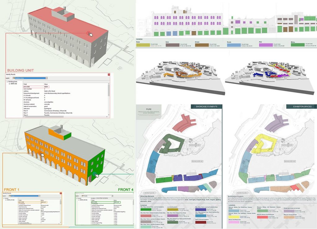
 The development of census archives as n-dimensional information containers of the urban context data has the objective of ordering, within a database, constructive, typological and formal characteristics of individual building units, for the management and understanding of signs and building technologies.
- Structuring for homogeneous descriptors, queries and specific fields according to architectural, technological and cultural sectors of elements, monuments and services, creating an interactive archival system able to insert and provide information for operational intervention on city planning.
- Interactivity of G.I.S. cartography.
- Application to 3D models for complex analysis and simulations, visualizing past and future scenarios of urban environment for the monitoring, design and planning of territory on a large scale in complex social and management dynamics.
- Creation of thematic maps, 2D and 3D elaborations representing specific chosen themes, allowing to read urban “layers”.

